Trip to Preikestolen (Pulpit Rock)
Click for a Spanish version of this trip report
 Preikestolen
is one of Stavanger's most popular tourist attractions (together with the
equally amazing Kjerag). In the following
trip report I will give some details about my trips to Preikestolen or Prekestolen
as it is also known by. Preikestolen is known as the Pulpit rock in English (which is a
direct translation of the Norwegian name) and I think you will
understand why when you see the pictures on this page (or when you get to
see it with your own eyes :-)
 First
of all a little bit on how you can get there: you have to take a ferry from
Stavanger to Tau (time tables can be found on
norled.no). The
trip takes a maximum of 40 minutes and it costs about 170 kroner (20 USD) for a car
(including the driver) and about 55 kroner (7 USD) for each person. When you get to
Tau you should take route 13 towards Sandnes and then follow the brown signs
leading the way to the Preikestolen parking. I think the parking costs about
200
kroner (24 USD) for a standard car (there are different prices for motorcycles, RV's
and so on).
 I
got in touch with a Canadian girl named Caroline on Lonely Planet Thorn Tree
and I bragged about how beautiful my hometown Stavanger is and the great
view that you can get from Preikestolen. To make a long story short I ended
up being a tour guide for Caroline when she came to Stavanger and the first
thing I wanted to show her was Preikestolen of course. We had to get up
pretty early on Sunday morning because we wanted to catch the 07.20 ferry to
Tau but it was worth it...when we came to the parking at Preikestolen I
think we were the first ones there :-)
 The
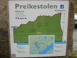
trip from the parking to Prekestolen is not really that far. In distance it
is about 3.8 kilometers (2.4 miles) but it can take about 1 hour and 30 minutes to the
top. The parking is at about 270 meters above sea level and Prekestolen is
at 600 meters which means that there is a 330 meters (1080 feet) height difference. The path
leading up to Preikestolen has been improved a lot since the first time I
went up there but you still need a pair of good shoes (or boots).
As the height difference suggest it is a bit of a climb at some places so
bring some water, some snack and maybe even some dry clothes. Finding the
way to the top is not a problem at all - just follow the path and if you
can't see a path then you can look for the red T's :-) The path varies from
gravel path, rocks and wooden paths. On the way up you will also find some
benches and tables that can be used if you want to take a break and enjoy
some of the food that you have brought along.
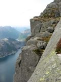 We
started walking at about 8.30 and we walked alone all the way up to
Preikestolen. I was quite surprised that we were alone because this is one
of the major tourist attractions in the area and it can be pretty crowded in
the summer time. But I guess it was a combination that it is early in the
season, it was early in the morning and the weather forecast was not great.
But I'm not complaining...in fact it made it into a really special
experience. When we got up to the top we were more or less alone there - apart
from a
couple had spent the night in a tent there so we could enjoy the view and
take some pictures of the place.
 So
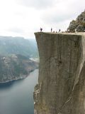
what is unique with this place? Well, as the name indicates (and the
pictures show) this looks like a pulpit when seen from below. The rock
itself is something like 25 by 25 meters and when you stand on the edge it
is basically 600 meters (1970 feet) straight down to the Lyse fjord . And on clear days you get a great
view of the Lysefjord. The path leading up to Preikestolen is also very
scenic - especially the last part when you start getting the first
glimpse of the Lyse fjord.
 There
was a big debate a few years ago in the local community by the way. Some
people suggested that a pier should be constructed in Lysefjord and a lift
should be built from the fjord to the Pulpit rock. I am sure that this would
have attracted quite a lot of cruise ships to the Stavanger area but on the
other hand I think it would have spoiled some of the experience. A few years
ago there used to be a little "shop" on top of Prekestolen. The girl who
worked there walked up every morning carrying some of the supplies on her
back. I guess that is the kind of summer job that makes you fit :-)
 On
the way down we met quite a few on their way up and some had the traditional
question "How much longer to Preikestolen?" :-) It is always fun serving a
white lie telling them that there is still 3 hours to go just to see how
people react :-) Or even telling them that there are so many people there
that you have to get in line to take a picture. But we did of course set the
record straight before we said goodbye to people. We met a lot of different
nationalities on the way: Norwegians, Danes, Swedes, Dutchmen, Germans and so
on. I guess that proves that it is truly one of the major attractions in
Stavanger.
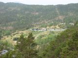 There
are quite a few other trails in the area so if you like trekking it is
possible to stay at the youth hostel Preikestolen fjellstue which is located near
the parking lot. And if you don't want to stay there you can just stop by to
get some Norwegian dishes...like komle (it is a mix between potato and flour
made into balls - potato dumplings in other words :-). Well, for more information please check out
their website.
In the summer it is easy to get to Preikestolen as there is a bus service -
Google it and you will find the details. But outside the main season it has
been tricky for people to make it here but now there is a tour company
called Outdoorlife
Norway that offers tours both in the summer and wintertime - that is
excellent!
 When
going back to Stavanger you have the option of going back the same when as
you came. It is also possible to follow route 13 to Oanes. At this place you
can make a stop at
Lysefjordsenteret where you can have a meal or just look
at the view. From here you can take a 10 minute ferry over to Lauvik and
from there you can drive back to Stavanger. We decided that it was too early
to quit so we took a left turn and drove towards Oltedal. Our destination
was Byrkjedal and the
Byrkjedalstunet. This is a former cheese dairy but now it has been
turned into a place where they make candles (kids can even try to make
candles themselves) and sell souvenirs. There is also a pretty good
restaurant here if you want to taste Norwegian food.
 From
Byrkjedal it is only a short drive to Frafjord and another attraction:
Månafossen. Månafossen is the highest waterfall in the Rogaland area if I'm
not mistaken. It was a scenic drive there by the way. We got to signs saying
"Drive carefully...the lambs are playing" and soon we saw sheep and their
lambs walking around on the road.
 After parking (and paying 20 kroner for
the parking) we walked the short walk to the lookout point to see the
waterfall. Unfortunately it had started raining so it was not the best view.
But it was still a very nice experience. Well,
I hope that this has been of some help to people that want to see
Preikestolen and the surrounding area. I had great fun showing all of this
to Caroline because she seemed to be very impressed with the mountains, the
scenery and so on. For me this was a super nice trip :-) If you have any
questions please do not hesitate to get in touch with me - you can get in
touch with me on
gardkarlsen@hotmail.com .
Here is a video that shows a couple of scenes from
the walk up to the top and from the top itself. I took this video when I
walked up there in 2011.