Trip to Kjerag - June 2003
Click for a Spanish version of this trip report
Kjerag has become a quite popular hiking destination in the last few years. Some go there because Preikestolen has become too crowded, some people go to jump onto Kjeragbolten and quite a lot of BASE jumpers go there to dive of the mighty cliffs (video taken in July 2005, about 2 MB). In this trip report you will find a bit of information about my trip to Kjerag on the 1st of June 2003.
 So
how do you get to Kjerag? It is quite a long way to drive so it is best to
start early. Take route E39 out of Stavanger and drive to Ålgård. Right
after Ålgård you turn left to go on route 45 to Sirdalen. On the way you
drive through Oltedal, Dirdal and Byrkjedal. On the way you will pass a new
toll station at Øvstabø but I think that this is free for tourists (there is
no manual way to pay the toll fee at least). Turn left at Sinnes, and go
past Fidjeland and then turn left again towards Lysebotn. It is a pretty
nice drive because it is quite scenic. The road leading from route 45 to
Lysebotn is also quite "fun".
 This narrow road was built in connection with
the power plants that are built in this area and it reaches a maximum height
of 932 meters above sea level. At this altitude there is a lot of snow in
the winter and the road is normally opened in May and close for the winter
in October. But even in June you can experience snow along the road. If you
want to drive it is about 130 km from Stavanger so it takes about 1 hour 45
minutes to 2 hours to drive there.
The other way to get there is to take a boat from Stavanger to Lysebotn.
From the middle of June to the middle of August you can catch the ferry
daily at 10 am (more information on can be found on
Stavanger region). You can also do a combination: in July 2005 we
drove to Kjerag and we took the boat home from Lysebotn at about 15.30 in
the afternoon. We took the small ferry Fjordlys but this is so small that
you have to call in advance to book if you want to take the car with you :-)
In the summer you can get to Kjerag as there is a bus service - Google it
and you will find the details. But outside the main season it has been
tricky for people to make it here but now there is a tour company called Outdoorlife
Norway that offers tours outside the main season - that is
excellent!
 I
have been to Kjerag a number of times before and this time I went with my
brother Jone. We started from Stavanger at 6.30 am on this Sunday morning
and after 1 hour and 45 minutes we reached the parking at Øygardsstøl
located at about 600 meters above Lysefjord. Øygardsstøl has also got the
nickname Eagle's nest because it seems to be on the edge of Lysefjord. Here
you can buy something to drink and eat but I would recommend that you do
this when you come back after the walk to Kjerag :-) The parking costs 60
kroner by the way.
 We
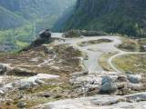
got on our hiking boots and packed our bags and started the walk. There is a
sign when you start walking the gives you more information about the trip
and a profile of the climb that you are about to embark on. I think it is
the first climb that's the worst....there is a almost 200 meter height
difference from the parking to the top of the first hill and it is pretty
steep. Due to this it is best to take this trip when it is dry because it
can be quite slippery when it rains. All in all it is about 6 km to
Kjeragbolten and there is a total climb of about 500 meters. If you go to
Preikestolen you will see that there is a steady climb all the way to the
top. At Kjerag you go up and down, up and down and then you climb to reach a
plateau (as the profiles shows).
 It
is not a problem finding the way to Kjerag. To start with you will be
walking on granite and the path has been marked with red T’s. In the
steepest hills chains has been put
  up to help the hikers haul their way to
the top. Later on you will see that a path has been built to try to make
people walk in one place instead of destroying all the vegetation in the
area.
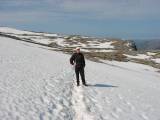
When Jone and I started walking we walked more or less alone all the way
into Kjerag and I guess the reason is that we were up bright and early and
it was still pretty early in the tourist season. If you walk to Kjerag this
early you have to be prepared to walk through some snow when you reach the
plateau. But the snow was pretty packed and didn’t cause and problem for us.
 After
about 2 hours we reached Kjerag. And when I walked to the edge I remembered
why this is such an amazing place. When you reach Kjerag and stand on the
edge (if you dare) you can look down at the Lysefjord about 1000 meters (about
3000 feet) below.
 I’m not sure that I can describe how amazing it really is and I don’t think
that any of the pictures that I have taken really shows how impressive this
place really is. You just have to go there and see for yourselves :-) As I
mentioned earlier this place has become quite popular for
BASE jumpers
(this is a 2MB video) and
you are likely to see many if you go there in the main season. It is quite
scary to watch them as they jump of the mountain. There have been some
accidents here in the last years but it is still legal to do skydive from
the mountain.
 After
we had enjoyed the view at Kjerag we walked the few hundred meters to reach
Kjeragbolten. In my opinion this is one of nature's wonders and it is
certainly one of the most amazing natural motifs that I have come across.
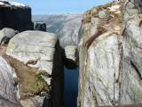
Kjeragbolten is a big rock that has fallen into a crack in the mountain and
there it has been wedged into the crack.
 And
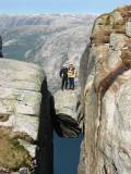
it is possible to make your way out on the rock and from a certain angle it
looks amazing. When we got there we met two German girls and we got
them to take a picture of both of us on Kjeragbolten. Yes, the rock is
really located about 1000 meter above the fjord so the knees have a tendency of
being a bit weak when you walk on to the rock. After the 2 hour walk it was
nice to just sit down and relax with a couple of slices of bread with the
traditional brown cheese (brunost is cheese made out of goat milk and it is
great with honey on top…trust me :-). There were only 2 other people there
while we were there. The other times that I have been there it has been very
crowded and you must almost get in line to get onto Kjeragbolten.
 After
relaxing for a while it was time to head back. As the day progressed it got
warmer and warmer and we could start taking some of our clothes of. On the
way back we met lots of people on their way up. The trip back is a pretty
exhausting as well. Sure, you are going down but there are still some
climbs and it is quite exhausting using your muscles to hold back. When we
got back to the parking lot we checked our watches and we had used 5 hours
to complete the trip.
Driving the 2 hours back to Stavanger is always a bit boring. On the way you can stop at Byrkjedalstunet to get some Norwegian food :-)
 Conclusion: This is a great little trip
if you want to get out of Stavanger for a day and I
think that the view of Lysefjord is amazing on nice clear summer days. And you get lots of thrills by
stepping onto Kjeragbolten. Remember to put on good hiking shoes before you start
walking and bring a bag with extra clothes, some water to drink and so on.
The weather can change pretty fast and even if it is warm at the parking lot
it can be quite cold on the plateau at 1000 meters. The last couple of times
I have been there I have seen an increasing amount of thrash along the way.
Please remember to bring your own garbage down to the parking lot again! If you have any
questions please do not hesitate to get in touch with me. I will try my very
best to give you some good and honest answers :-)
Do you need driving instructions? Please try to download this KMZ file. This can be displayed in Google Earth.